An extensive gold target over 3km in length and in places 2km wide with potential for high tonnage and gold content has been discovered near Clay Lake in the Orlock Bridge gold trend. Gold intersections of up to 100metres, which is believed to be the longest continuous gold intersection in the British Isles, have been drilled on this target. The Clay Lake gold target lies 7 km (4.5 miles) northeast of the Clontibret gold target
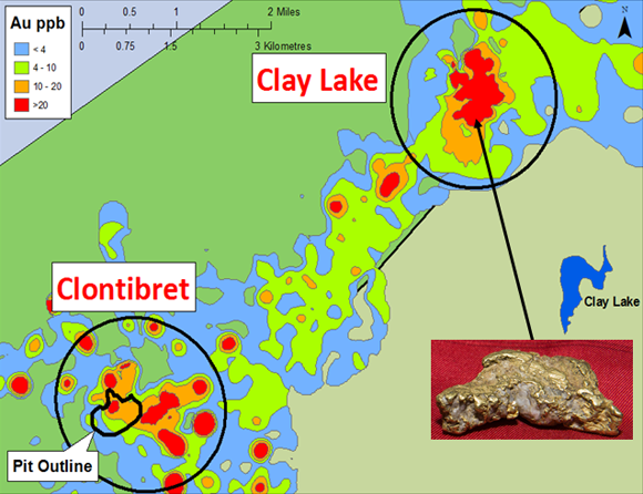
Gold-in-soil values averaging over 50 ppb Au, including the highest gold-in-soil value seen to date, 1,531 ppb Au (1.53 g/t gold), were recorded in soil samples collected over the Clay Lake target area during the Company’s exploration programme.

The Clay Lake gold target lies 7 km (4.5 miles) northeast of the Clontibret gold target.
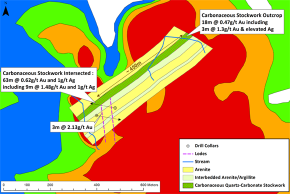
Rock chip samples identified gold in bedrock which comes to surface in the northern part of the Clay Lake target in the form of a black carbonaceous stockwork. The rock chip samples in the exposed rock returned 18 metres at 0.47 g/t gold and included 3 metres at 1.30 g/t gold before the exposure ceased.
 | |
| The map shows contours of gold-in-soil results; the orange areas are above 10 ppb Au, which is very anomalous for gold, and the red areas are above 20 ppm Au. |
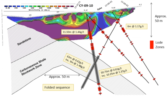
Subsequent drilling identified a 450 metre open ended zone of black carbonaceous stockwork with the second drill hole intersecting 63 metres @ 0.62 g/t gold including 9 metres @ 1.48 g/t gold. This black carbonaceous stockwork zone appears to be part of a plunging anticline, which may form a repeating sequence of gold-bearing saddle reef structures.

Clay Lake gold target cross section
Gold potential at Clay Lake
While work on the Clay Lake target is still at a relatively early stage, long gold intersections encountered in drilling to date suggest the potential for very high tonnage and overall gold content.

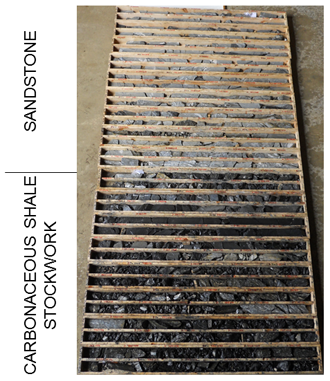
Clay Lake Drill Core – Sandstone and Carbonaceous Shale Stockwork Zone
